
 Here is information about Sheet 3:
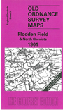
The Ordnance Survey originally titled this map 'Ford'. It covers a rural area of north Northumberland, from Cornhill eastward to Ford, southward to Kirknewton and Earle. We have named it after the Battle of Flodden Field, 1513, the site of which is near the centre of the map. This is border country but please note that the area of Scotland is left blank, except for Coldstream itself, which is included. A detailed map of Cornhill (which includes Coldstream station) is on the back. The NER Coldstream and Kelso branches shown on the one-inch map will be of interest to railway historians.
It is not possible to list the many hamlets, farmsteads and other topographical features shown on these maps. However, you may find it useful if we list the towns and principal villages or church parishes that are included on this map. Links are given for those for which detailed large-scale maps are also available.
Index maps are available showing the areas covered by the Inch to the Mile maps. Go to This page
You can order maps direct from our On-line Mapshop. For a full list of Inch to the Mile maps go to the Inch to the Mile page, where you will also find details of prices. For information on the rest of the series, go to The Index Page.