Old Ordnance Survey Maps of Nottinghamshire

  • These detailed maps normally cover an area of about one and a half miles by one mile. Each map includes an introduction.
  • They are available through our On-line Mapshop

  • Here are the details of maps for Nottingham East:

  • Notts Sheet 42.03 Nottingham (East) & Colwick Park 1913 - published 2025; intro by Barrie Trinder. ISBN.978-1-78721-881-9

    This map covers an area to the east of Nottingham and is double-sided for maximum coverage.

    The main map covers the easternmost streets of Nottingham, off Sneinton Dale and Sneinton Boulevard, with the Great Northern Railway and Thorneywood Station. It extends east to Colwick House and the Midland Railway's Nottingham & Lincoln line.

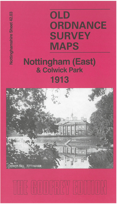
    The map on the reverse extends coverage southward to include St Christopher's Church, Trent Lane Junction, Colwick Hall, Colwick Park and most of the racecourse.

    The map links up with sheet 42.02 Nottingham to the west and 42.04 Colwick to the east.


  • Follow this link for a complete list of our Nottinghamshire Series maps. For other information and prices, and other areas, go to The Index Page.
  • Maps in the Godfrey Edition are taken from the 25 inch to the mile map and reduced to about 15 inches to the mile. For a full list of maps for the East Midlands, return to the East Midlands page.
    The Godfrey Edition / sales@alangodfreymaps.co.uk / 4 September 2025