
 Here are the details of maps for Newark (East):

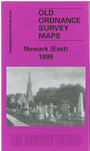
This very detailed map covers the eastern part of Newark, with coverage stretching from Wellington Road eastward to Hillside and beyond.
Features include GNR railway with Newark Junction but not station, gas works, Hatton House, engine shed, Beaconhill Road area, Cemetery (at foot of map), malthouse with railway connection, Hillside, Beacon Hill, Highfield, Great Northern Brick Works etc. On the reverse we include street directory entries for Barnby Gate, Barnby Road, Beacon Hill, Beacon Hill Road, Charles Street, Cross Street, Harcourt Street, Private Street, Vernon Street, Wellington Street.
The map links up with Notts sheet 35.03 Newark to the west and 30.16 Newark North to the north.