Old Ordnance Survey Maps of Northamptonshire

  • These detailed maps normally cover an area of about one and a half miles by one mile. Each map includes an introduction.
  • They are available through our On-line Mapshop

  • Here are the details of maps for Oundle:

  • Northants Sheet 19.05 Oundle 1899 - published 2025; intro by Barrie Trinder. ISBN.978-1-78721-891-8

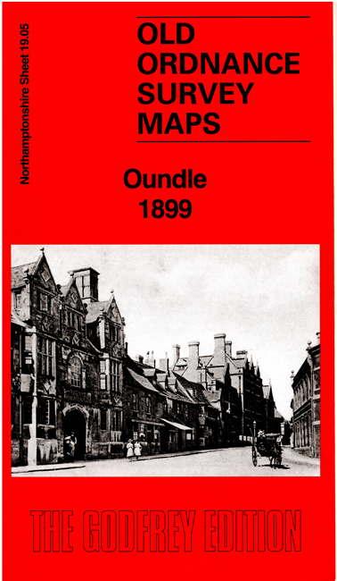
    This detailed map gives excellent coverage of the small town of Oundle.

    Features include the town centre with individual buildings neatly shown, St Peter's church, Market Place, Oundle School, The Rectory, Laundimer House, Herne Lodge, Anchor Brewery, South Bridge, chapels, railway (but not station), Ashton Corn Mill, Jesus Church, cemetery, etc.

    On the reverse we include extracts from an 1898 directory of Oundle together with a specially written introduction to the history of the town.


  • Follow this link for a complete list of our Northamptonshire maps. For other information and prices, and other areas, go to The Index Page.
  • Maps in the Godfrey Edition are taken from the 25 inch to the mile map and reduced to about 15 inches to the mile. For a full list of maps for England, return to the England page.
    Alan Godfrey Maps, Prospect Business Park, Leadgate, Consett, Co Durham, DH8 7PW / sales@alangodfreymaps.co.uk / 18 August 2025