Old Ordnance Survey Maps of Norfolk

  • These detailed maps normally cover an area of about one and a half miles by one mile. Each map includes an introduction.
  • They are available through our On-line Mapshop

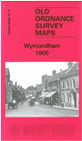
  • Here are the details of maps for Wymondham:

  • Norfolk Sheet 74.14 Wymondham 1905 - published 2014; intro by Tony Kirby. ISBN.978-1-84784-765-2

    This detailed map is double-sided to give maximum coverage of Wymondham.

    The main map covers the centre and south of the town. Features include railway with station and junctions; parish church, Cavick House, Brush Factory, Damgate Bridge, Market Street and town centre with individual buildings neatly shown, Browick Windmill, cemetery, The Fairland, allotments, The Lizard etc.

    The backing map shows the north of the town including Town Green, Rattle Row and Folly Lane.


  • Follow this link for a complete list of our Norfolk or Suffolk map; or for a full list of maps for East Anglia, go to the East Anglia page.
  • Most maps in the Godfrey Edition are taken from the 25 inch to the mile map and reduced to about 15 inches to the mile. You can order maps direct from our On-line Mapshop. For other information and Prices, see Index Page.
    The Godfrey Edition / sales@alangodfreymaps.co.uk / 28 January 2018