Old Ordnance Survey Maps of Norfolk

  • These detailed maps normally cover an area of about one and a half miles by one mile. Each map includes an introduction.
  • They are available through our On-line Mapshop

  • Here are the details of maps for Norwich NW:

  • Norfolk 63.10 Norwich (NW) 1905 - published 2004; intro by Robert Malster. ISBN.978-1-84151-707-0

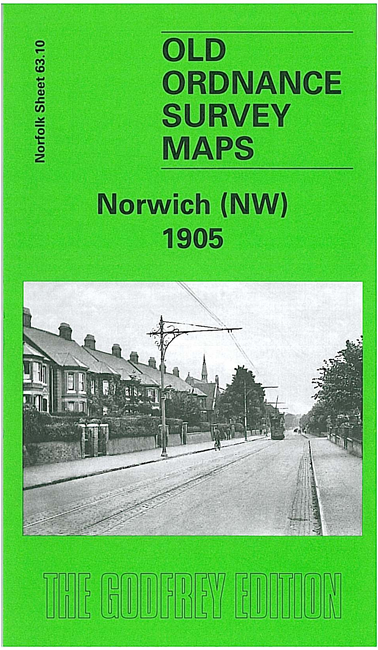
    This detailed map is centred on the Dereham Road area, with suburbs stretching west from the city. Coverage stretches from Gladstone St and Adelaide St westward one and a half miles to Earlham Grove and open country; and from Earlham Road northward to the River Wensum and the Midland & Great Northern Joint Railway.

    Features include the cemetery, Workhouse, isolation hospital, tramways along Earlham Road and Dereham Road, Northumberland St, Armes St. On the back we include a selection of entries from a contemporary directory.

    The map links up with sheet 63.11 Norwich North to the east.


  • Follow this link for a complete list of our Norfolk or Suffolk map; or for a full list of maps for East Anglia, go to the East Anglia page.
  • Most maps in the Godfrey Edition are taken from the 25 inch to the mile map and reduced to about 15 inches to the mile. You can order maps direct from our On-line Mapshop. For other information and Prices, see Index Page.
    The Godfrey Edition / sales@alangodfreymaps.co.uk / 10 November 2023