Old Ordnance Survey Maps of Norfolk

  • These detailed maps normally cover an area of about one and a half miles by one mile. Each map includes an introduction.
  • They are available through our On-line Mapshop

  • Here are the details of maps for East Dereham:

  • Norfolk Sheet 49.13 East Dereham 1926 - published 2006; intro by Robert Malster. ISBN.978-1-84151-865-7

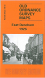
    This detailed map gives good coverage of East Dereham. Features include all of the town centre, including Market Place, St Nicholas church, High Street, Baxter Row, London Road, Theatre Street, Norwich Street, Swaffham Road, station, engine shed and junctions, malthouses, engineering works. Coverage extends north to the cemetery, south to Moorgate House, west to Draytonhall Lane. On the reverse we include extracts from a 1929 directory, including the list of private residents.


  • Follow this link for a complete list of our Norfolk or Suffolk map; or for a full list of maps for East Anglia, go to the East Anglia page.
  • Most maps in the Godfrey Edition are taken from the 25 inch to the mile map and reduced to about 15 inches to the mile. You can order maps direct from our On-line Mapshop. For other information and Prices, see Index Page.
    The Godfrey Edition / sales@alangodfreymaps.co.uk / 28 January 2018