Old Ordnance Survey Maps of Norfolk

  • These detailed maps normally cover an area of about one and a half miles by one mile. Each map includes an introduction.
  • They are available through our On-line Mapshop

  • Here are the details of maps for King's Lynn:

  • Norfolk Sheet 33.10 King's Lynn 1904 - published 2015; intro by Richard Oliver. ISBN.978-1-84784-887-1

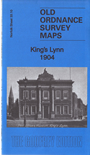
    This detailed map covers the centre of King's Lynn, with coverage stretching from Alexandra Dock southward to Guanock Terrace.

    The many features include railways with terminus, Workhouse, St James's End, Highgate, part of West Lynn, St Nicholas Chapel, St Margaret's church, All Saints church, Alexandra Dock, Dock Railway, North End, South Quay, part of Gaywood Park, engine shed, St John's church, Lower Canada, GER Harbour Branch, etc. Directory extracts are included on the reverse.

    The map links up with sheet 33.14 South Lynn to the south.


  • Follow this link for a complete list of our Norfolk or Suffolk map; or for a full list of maps for East Anglia, go to the East Anglia page.
  • Most maps in the Godfrey Edition are taken from the 25 inch to the mile map and reduced to about 15 inches to the mile. You can order maps direct from our On-line Mapshop. For other information and Prices, see Index Page.
    The Godfrey Edition / sales@alangodfreymaps.co.uk / 28 January 2018