
 Here are the details of maps for Sheringham & West Runton:

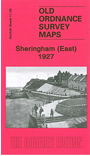
This detailed map covers the eastern half of Sheringham, and extends east to cover part of West Runton. Features include Promenade, High Street, Wyndham Street, Back Common, Sheringham House, St Joseph's RC church, Beeston Regis Hills, Beeston Regis Hall, West Runton station (at eastern margin), Runton Hill, Holy Trinity church.On the reverse we include a 1929 commercial directory for Sheringham. Alan Crosby describes the area as historically "a landscape of long sandy shorelines, lonely and elemental; wave-battered crumbling cliffs, slipping and sliding every winter as the sea gnawed away the soft material at their base...." The real catalyst for Sheringham's emergence as a resort was the arrival of the railway in the late 19th century, and his essay describes the town's growth.