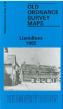
 Here are the details of maps for Llanidloes :

This detailed map is double-sided to give maximum coverage of this mid Wales town. The main map covers the town centre and the area to the west, stretching about a mile along the Severn valley to Pen y Banc, Coed Caecrwn and a Woollen Mill. Features on this map include the town centre in detail, including St Idloes church, Upper Green, Great Oak Street, Short Bridge Street, Long Bridge Street, China Street, Smithfield Street, Cambrian Mill, Glan-Clywedog Mill, High Street, Spring Mill; also coverage south to Lower Glandulas. On the reverse we include a section of adjacent map 48.01 which extends coverage further east and includes the railway station, engine shed, Lower Green, Hafron Terrace, Nant-Bryn-Du. The introduction, in both Welsh and English, is by E Ronald Morris.