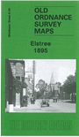
Middlesex Sheet 6.05 Elstree 1895 - published 2009; intro by Pamela Taylor. ISBN.978-1-84784-322-7 
This map is also Hertfordshire sheet 45.05. It covers the area from Elstree village eastward to Woodcock Hill, and northward to the southern end of Elstree & Borehamwood station.
Features include Elstree village, Hill House, St Nicholas church, Edgwarebury House, Deacons Hill, Woodcock Hill, Elstree Tunnel, Allum Lane, Artichoke pub. On the reverse we include directories of Elstree in 1895 and of Little Stanmore with Edgware in 1890.

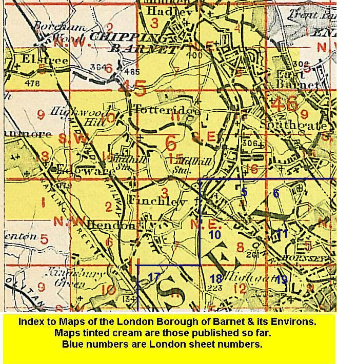
Follow this link for a list of our maps for the London Borough of Barnet, or here for a complete list of our London maps .
You can order maps direct from our On-line Mapshop.
For other information and prices, and other areas, go to The Index Page.
Maps in the Godfrey Edition are taken from the 25 inch to the mile map and reduced to about 15 inches to the mile.
For a full list of maps for England, return to the England page.
Alan Godfrey Maps, Prospect Business Park, Leadgate, Consett, Co Durham, DH8 7PW / sales@alangodfreymaps.co.uk / 15 January 2018

 Here are the details of maps for Elstree: