
 Here are the details of the map for the Elephant area:

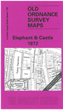
This highly detailed map at a 'Yard to the Mile' scale covers the area around and to the north of the Elephant & Castle pub. Coverage stretches north to Borough Road. Features include a stretch of the LCDR railway with Elephant & Castle station, St Matthew's church New Kent Road, Metropolitan Tabernacle, Taylor's Depository, British & Foreign School Society's Training College, Surrey County Gaol and Sessions House (shown in detail), Holy Trinity church at Trinity Square. On the reverse we include street directory entries for Borough Road, London Road, Newington Causeway, New Kent Road, St George's Circus, St George's Road, Trinity Square, etc
The map links up with sheets 7.85 The Borough to the north, 7.94 Lambeth Road to the west and 11.05 Newington Butts to the south and 7.96 Bermondsey W to the east.