
 Here are the details of the map for the St Paul's Cathedral area:

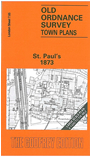
This highly detailed map at a 'Yard to the Mile' scale covers a fascinating area of the City of London, centred on St Paul's Cathedral. This building is shown in splendid detail, even including the interior layout, as are many other buildings on this important map. Coverage overall stretches from Farringdon Street eastward to Ironmonger Lane, and from Upper Thames Street northward to Aldermanbury. Features on the map include General Post Office, Goldsmiths Hall, St Vedast's church, Christ Church Newgate Street, Newgate Gaol, Ludgate Hill station, Bridewell Hospital, College of Arms, St Benet's church, Mansion House station, St Mildred's church, City of London School, Guildhall (top right corner), Mercers Hall, St Mary le Bow church and several other City churches, Skinners Hall (bottom right corner). On the reverse we include street directory entries for Cheapside, Ludgate Hill, Newgate Street, Old Bailey, Paternoster Row, Upper Thames Street in 1859.
The map links up with sheets 7.64 Fleet Street to the west, 7.66 Bank to the east, 7.77 Bankside to the south.