
 Here are the details of the map for the Fitzroy Square area:

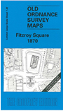
This highly detailed map at a 'Yard to the Mile' scale covers part of St Pancras. Coverage stretches from Park Crescent eastward to Gower Street and Melton Street, and from Fitzroy Square northward to Netley Street and Clarence Gardens. Features on the map include Portland Road (now Great Portland Street) station, Holy Trinity church, Baptist Chapel Park Square, St Mary Magdalen's church, Adult Orphan Institution, Congregational Chapel Tolmer's Square, University College and Hospital, St Saviour's church, these all shown in detail with interior layouts. On the reverse we include the 1894 map for the same area, at a slightly reduced scale.
The map links up with Sheets 7.32 Euston to the north, 7.41 Upper Baker Street to the east, 7.43 North Bloomsbury to the east, 7.52 Langham Place to the south.