
 Here are the details of the map for the Angel area:

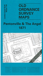
This highly detailed map at a 'Yard to the Mile' scale covers an area from Winchester Street eastward to the Angel Inn, and from Chapel Street southward to Lloyd Square. Pentonville Road runs west-east across the map. Features include Percy Circus, Police Station, London Female Penitentiary, St James church Pentonville, St Silas church John Street, St Mark's church Myddelton Square, New River Head, Sadlers Wells Theatre, Philharmonic Theatre Royal. On the reverse we include street directory entries for Chapel Street, Collier Street, Great Percy Street, Holford Square, Islington High Street, Lloyd Square, Myddelton Square, Pentonville Road, Percy Circus.
The map links up with Sheets 7.33 Kings Cross to the west.