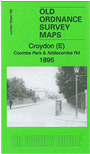
London Sheet 158 Croydon (E): Coombe Park & Addiscombe Road 1895 - published 2014; intro by Richard Oliver. ISBN.978-1-84784-809-3 
This detailed map covers the eastern part of Croydon, from the Addiscombe Road southward to Coombe Park.
Features include Shirley House, Addiscombe Farm, Coombe Lane station, Parkhill House, Brickwood House, St Mary Magdalene church, Addiscombe Road etc. Extracts from a 1934 street directory are included on the reverse.
The map links up with sheets 155 Croydon NE to the north, 157 Croydon to the west and 160 Addington Hills to the south.
Follow this link for a complete list of our Croydon maps.
You can order maps direct from our On-line Mapshop.
For other information and prices, and other areas, go to The Index Page.
Maps in the Godfrey Edition are taken from the 25 inch to the mile map and reduced to about 15 inches to the mile.
For a full list of maps for England, return to the England page.
Alan Godfrey Maps, Prospect Business Park, Leadgate, Consett, Co Durham, DH8 7PW / sales@alangodfreymaps.co.uk / 5 February 2018

 Here are the details of maps for East Croydon :