Old Ordnance Survey Town Plans of London

  • These highly detailed maps, at a scale of 1:1760 or a Yard to the Mile, cover parts of central London in exceptional detail. They are available through our On-line Mapshop

  • Here are the details of the map for The Oval area:

  • London Large Scale Series Sheet 11.14 The Oval & Kennington Park 1871-93 - published 2023. Intro by Alan Godfrey. ISBN.978-1-78721-686-0

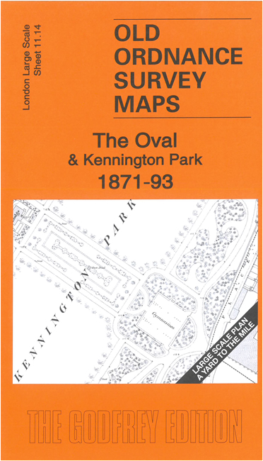
    This very detailed map covers the area of Kennington including The Oval and Kennington Park. It is double-sided, with the 1871 map on one side and a reduced version of the 1894 map on the area. We also include an introduction to the history of the area.

    Features (from 1871 map) include Oval cricket ground, Kennington Park, St Peter's church Vauxhall, St Peter's House, St Joseph's Convent, Vestry Hall, Licensed Victuallers School, Chemical Works, tramway etc.

    The map links up with sheet 11.04 North Kennington to the north and 11.13 Vauxhall to the west.


  • For other Town Plans go to the London Town Plans page. Here is an Index Grid
  • For a full list of maps for London and Middlesex, return to the London page.
  • For other information and prices, and other areas, go to The Home Page.
  • Maps are available through our On-line Mapshop
    Alan Godfrey Maps, Prospect Business Park, Leadgate, Consett, DH8 7PW. Tel 01207 583388
    The Godfrey Edition / sales@alangodfreymaps.co.uk / 23 January 2024