Old Ordnance Survey Town Plans of London

  • These highly detailed maps, at a scale of 1:1760 or a Yard to the Mile, cover parts of central London in exceptional detail. They are available through our On-line Mapshop

  • Here are the details of the map for the south Chelsea

  • London Large Scale Sheet 10.20 Chelsea Old Village 1865-92 - published 2024. Intro by Alan Godfrey. ISBN.978-1-78721-736-2

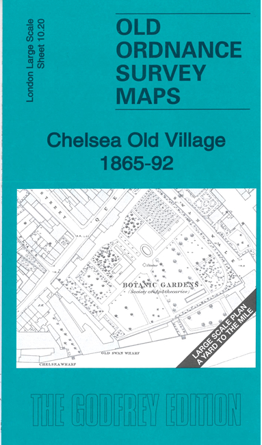
    This very detailed map covers the Chelsea Old village area from Cheyne Walk and the riverside northward to Chelsea Town Hall.

    Features include Chelsea Old Church, Botanic Gardens, Cheyne Row, Cadogan Pier, Church Street, The Rerctory, Oakley Street, etc. The fine detail includes the layout of many gardens.

    On the reverse we include the 1892 map of the same area, now including Albert Bridge. A 2,000 word introduction is also included.

    The map links up with sheet 10.10 Chelsea St Lukes to the north and 11.11 Royal Hospital to the east


  • For other Town Plans go to the London Town Plans page. Here is an Index Grid
  • For a full list of maps for London and Middlesex, return to the London page.
  • For other information and prices, and other areas, go to The Home Page.
    Alan Godfrey Maps, Prospect Business Park, Leadgate, Consett, DH8 7PW. Tel 01207 583388
    The Godfrey Edition / sales@alangodfreymaps.co.uk / 22 March 2024