
 Here are the details of maps for Isleworth:

We have published three versions of this map, showing how the area changed across the years. Note that, as with most 1930s maps, the area east and south of the river, in Surrey, is left blank on the 1935 version.
The maps cover the village centre of Isleworth, including Lower Square, South Street, Manor Mill, Gumley House convent, Nazareth House convent, Isleworth Brewery, and extends north to include Brentford workhouse, Smallbury Green, Syon House and much of Syon Park; also site of Battle of Brentford. Tramways are shown on the 1912 and 1935 versions.
East of the Thames on the 1894 and 1912 maps are part of the Old Deer Park, Kew Observatory, a few streets of Richmond around Kew Foot Road; in the NE is part of Kew Gardens, including Queen's Cottage Grounds. This Surrey area is blank on the 1935 map.
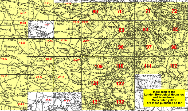
The map links up with London Sheets 83 Brentford to the north, 97 North Sheen to the east, and 110 Richmond to the south; and with Middlesex Sheet 20.07 Hounslow to the west.
 Follow this link for a list of our maps for the London Borough of Hounslow, or here for a complete list of our London maps .