Old Ordnance Survey Maps of Lincolnshire

  • These detailed maps normally cover an area of about one and a half miles by one mile. Each map includes an introduction.
  • They are available through our On-line Mapshop

  • Here are the details of maps for Market Rasen & Middle Rasen:

  • Lincolnshire Sheet 45.12 Market Rasen 1905 - published 2003; introduction by Nick Lyons. ISBN.978-1-84151-551-9

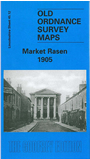
    This detailed map covers the market town of Market Rasen, and coverage also continues west to include part of Middle Rasen. Features on the map include Market Rasen Market Place, St Thomas church, station, The Elms, King Street, Queen Street, Clare Lodge, Willingham Street, Chapel Street, malthouses, saw mill, windmill, disused corn mill, Croft's Farm. At Middle Rasen features include site of church, Brook Cottage, Mount Pleasant. On the reverse we include directories for both Market Rasen and Middle Rasen in 1905.


  • Follow this link for a complete list of our Lincolnshire Series maps.
  • You can order maps direct from our On-line Mapshop. For other information and prices, and other areas, go to The Index Page.
  • Maps in the Godfrey Edition are taken from the 25 inch to the mile map and reduced to about 15 inches to the mile. For a full list of maps for England, return to the England page.
    Alan Godfrey Maps, Prospect Business Park, Leadgate, Consett, Co Durham, DH8 7PW / sales@alangodfreymaps.co.uk / 25 November 2016