 Here are the details of maps for Crowle:

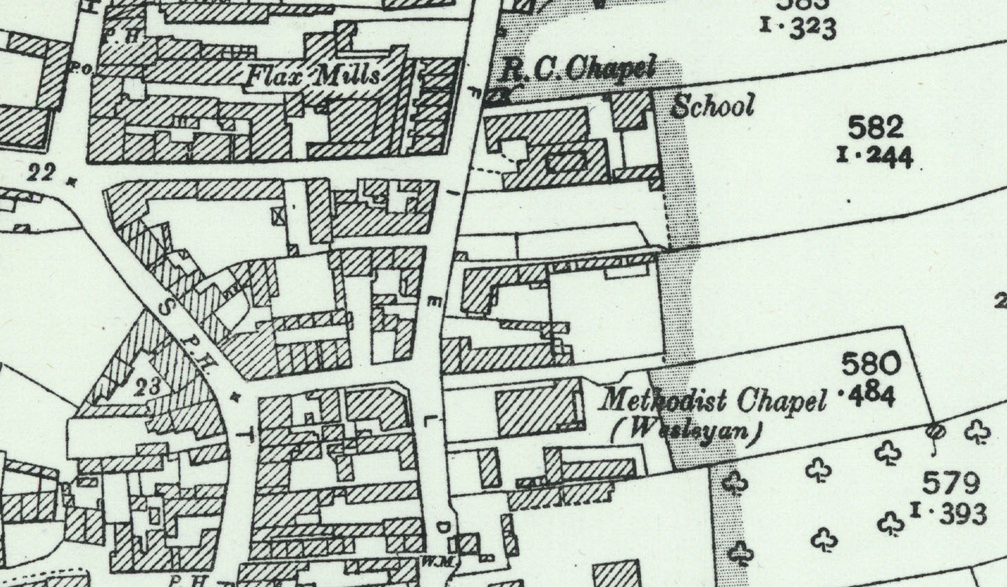
This map covers the little market town of Crowle, in the Isle of Axholme. The original OS sheetlines splie the town so we have published it as a composite from sheets 9.14 and 9.15.
Features include the town centre with individual buildings neatly shown, Axholme Joint Railway with Crowle station, Market Place, Isle of Axholme Brewery, Snowdrop Villa, Windsor, St Oswald's church, Manor House, Newbigg, chapels, schools, The Pit Holes, Godknow Road windmill, etc.
A 1905 directory of Crowle is included on the reverse.
Further information:
Crowle is a tiny north Lincolnshire town, today little more than a village, situated in the Isle of Axholme. Despite having a station on the Axholme Joint Railway, its population fell back from 3,122 in 1871 to just 2,767 by 1901. The OS sheetlines split the town awkwardly so in this case we have broken the habits of a lifetime and joined sections of maps 9.14 and 9.15 to give improved coverage of the town.


 .
.
"That rural character is maintained today but Crowle failed to grow as a town and in 1936 its urban district was abolished; it was absorbed by the Isle of Axholme rural district council, the authority which had governed the rural area around Crowle since 1894, had taken over Eastoft in 1896, and now looked after the whole of the Isle. At the time of our map the RDC met monthly at Epworth police station. Even then, Crowle’s credentials as a town were fragile, as shown by its three banks: the Union of London & Smiths Bank Ltd, open Tuesdays and Fridays only; the York City & County Banking Co Ltd, who opened on the same days but gained an advantage by opening at 10am rather than its competitor’s 10.30; and the Becketts Old Bank, which opened on Fridays only and then not until 11am. Clearly Crowle was a hive of activity on Friday, market day, but sleepy as a dormouse at most other times."