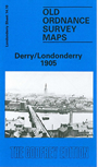
 Here are the details of maps for Derry or Londonderry:

This detailed map gives very good coverage of the City of Derry or Londonderry. Coverage stretches from Brooke Park southward to Carlisle Bridge, and from the Cemetery eastward to Glendermott Road.
This is a very busy map. Major features include the city centre shown in detail with individual houses neatly delineated; St Columb's Cathedral, St Columb's College, Distillery, Custom House, city walls, St Eugene's RC Cathedral, Christ Church, lunatic asylum, museum, shirt and collar factories, transit sheds on quayside, Queen's Quay, Prince's Quay, Abercorn Quay, St Augustine's church, bacon curing establishment, The Diamond, Butter Market, Nazareth House, tramways, Great Northern Railway with terminus, Guildhall, etc. On the east side of the River Foyle features include Donegal Railway with part of terminus (southerm margin of map), Midland Railway with terminus, Waterside area, St Columb's RC church, Waterside Distillery, workhouse, Ebrington Barracks, St Columb's chapel etc. On the reverse we include a selection of street directory entries.