
 Here are the details of maps for Brandon & Langley Moor:

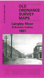
This very detailed map covers the pit villages of Langley Moor and Brandon Colliery. The NER main line, Bishop Auckland Branch and Dearness Valley Branch all run through the map - the latter two are now cycle-ways and paths. The two villages are shown in detail, with houses, outhouses etc though their collieries are off this map (see Meadowfield map). However, at the north of the map is Broompark Colliery, while the disused Boyne Colliery and Brandon Colliery coke ovens are on this map. The map extends eastward to Langley Grove and Stonebridge Mill. On the reverse we include a good extract from the 1915 revision of the map, showing the development of the two pit villages; a new Pithouse Wagonway has been opened from Brandon Junction.
The map links up with Sheets 27.05 Durham City (South) to the east, 26.12 Meadowfield to the south.