Old Ordnance Survey Maps of Lancashire

  • These detailed maps normally cover an area of about one and a half miles by one mile. Each map includes an introduction.
  • They are available through our On-line Mapshop

  • Here are the details of maps for Huyton:

  • Lancashire Sheet 107.10 Huyton 1906 - published 2013; intro by Kay Parrott. ISBN.978-1-84784-713-3

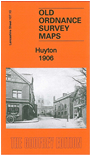
    This detailed map covers Huyton when it was still a village, with coverage from the railway station northward to Hurst House.

    Features include Huyton Quarry station, Whiston Hall, Pluckington Farm, Hurst House, St Gabriel's church, Huyton station, Parkside House, Wastle Bridge, tramway, St Michael's church etc. We include extracts from a 1918 street directory on the reverse.

    The map links up with Lancashire Sheets 107.09 Roby to the west, 107.11 Whiston to the east.


  • Follow this link for a complete list of our Knowsley or Liverpool maps.
  • You can order maps direct from our On-line Mapshop. For other information and prices, and other areas, go to The Index Page.
  • Maps in the Godfrey Edition are taken from the 25 inch to the mile map and reduced to about 15 inches to the mile. For a full list of maps for the North West, return to the North West page.
    The Godfrey Edition / sales@alangodfreymaps.co.uk / 27 May 2018