
 Here are the details of maps for Prescot:

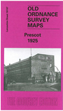
This detailed map covers the town of Prescot, a few miles east of Liverpool. Most of the town is shown, and coverage extends eastward to Seddon's Brow, northward to the Mizzy Plantations and No.2 Reservoir. The British Insulated & Helsby Cable Works are a major feature in the town, shown here with rail connection to the Huyton & St Helens line. Other features include Eccleston Lane Ends, tramways, printing works, Middleton House, Town Hall, St Mary's church, Market Hall, Prescot Nursery, Eccleston Park, St James church, all the buildings of the town centre shown neatly delineated, etc. We include a 1918 commercial directory of Prescot on the reverse.
The map links up with Lancashire Sheets 107.11 Whiston to the south.