Old Ordnance Survey Maps of Lancashire

  • These detailed maps normally cover an area of about one and a half miles by one mile. Each map includes an introduction.
  • They are available through our On-line Mapshop

  • Here are the details of maps for St Helens SW:

  • Lancashire Sheet 107.04 St Helens (SW) 1906 - published 1998; intro by Mary Presland. ISBN.978-0-85054-973-7

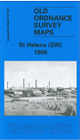
    This detailed map covers the SE area of St Helens, with coverage extending south to Thatto Heath Park, and westward to Eccleston Hill. and Eccleston Hall. Features include Eccleston Top Dam, tramways, Ravenhead British Plate Glass Works, Alexandra Colliery, Ravenhead Glass Bottle Works, Greengate Brick Works, Queen's Park, Big Dam, Liverpool Pottery, Stained Glass Works, West Park, St Ann's, etc. On the reverse we include a 1918 list of private residents for St Helens.

    The map links up with Lancashire Sheets 108.01 St Helens SE to the east and Thatto Heath to the south.


  • Follow this link for a complete list of our St Helens or Liverpool maps.
  • You can order maps direct from our On-line Mapshop. For other information and prices, and other areas, go to The Index Page.
  • Maps in the Godfrey Edition are taken from the 25 inch to the mile map and reduced to about 15 inches to the mile. For a full list of maps for the North West, return to the North West page.
    The Godfrey Edition / sales@alangodfreymaps.co.uk / 27 May 2018