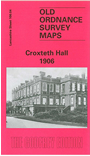
Lancashire Sheet 106.04 Croxteth Hall 1906 - published 2002; intro by Kay Parrott. ISBN.978-1-84151-450-0 
This detailed map covers the area from Carr Lane Farm eastward to Croxteth Hall.
Principal features on a fairly rural map include Croxteth Hall itself, Dog & Gun, Church of the Good Shepherd, Lower House, Norris Green.
This map links up with sheet 106.03 Walton to the west, 106.08 West Derby to the east.
Follow this link for a complete list of our Liverpool or Sefton maps.
You can order maps direct from our On-line Mapshop.
For other information and prices, and other areas, go to The Index Page.
Maps in the Godfrey Edition are taken from the 25 inch to the mile map and reduced to about 15 inches to the mile.
For a full list of maps for the North West, return to the North West page.
The Godfrey Edition / sales@alangodfreymaps.co.uk / 18 January 2018

 Here are the details of maps for Croxteth Hall: