Old Ordnance Survey Maps of Bolton MBC

  • These detailed maps normally cover an area of about one and a half miles by one mile. Each map includes an introduction.
  • They are available through our On-line Mapshop

  • Here are the details of maps for Westhoughton (West):

  • Lancashire Sheet 94.06 Hart Common & Dobb Brow 1907 - published 2013; intro by Derrick Pratt ISBN.978-1-84784-699-0

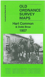
    This detailed map covers the area west of Westhoughton, from the cemetery westward to Crow Nest Junction.

    Features include 4 stretches of Lancashire & Yorkshire Railway (Hilton House line, Liverpool-Bolton line, Westhoughton Connecting line, Pendleton & Hindley line); The Grove, Grundy's Farm, Hewlett Pits (Nos 1 and 2), Hart Common Farm, most of Crow Nest Junction, Castle Hill Mill, colliery railways etc.

    The map links up with sheet 94.05 Kirklees to the west, 94.07 Westhoughton to the east, 94.10 Hindley Green North to the south.


    Follow this link for a complete list of our Bolton maps.
  • You can order maps direct from our On-line Mapshop. For other information and prices, and other areas, go to The Index Page.
  • Maps in the Godfrey Edition are taken from the 25 inch to the mile map and reduced to about 15 inches to the mile. For a full list of maps for the North West, return to the North West page.
    The Godfrey Edition / sales@alangodfreymaps.co.uk / 1 February 2018