Old Ordnance Survey Maps of Bolton MBC

  • These detailed maps normally cover an area of about one and a half miles by one mile. Each map includes an introduction.
  • They are available through our On-line Mapshop

  • Here are the details of maps for Cooper Turning

  • Lancashire Sheet 86.14 Hilton House 1907 - published 2013; intro by Derrick Pratt. ISBN.978-1-84784-674-7

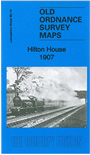
    This detailed map covers a largely rural area NW of Westhoughton, south of Horwich. It covers the area from Hilton House eastward to Lostock Lane.

    Features include Hilton House Branch with Hilton House station, mineral railways, Brinsop Hall, New Winnings Coal Pit, old shafts, Cooper Turning (at foot of map), stretch of Bolton & Preston line, Chadwick's Farm, Stone House Farm. On the reverse we include a 1914 timetable for the Wigan-Blackburn line.

    The map links up with Lancashire Sheets 86.10 Horwich (South) to the north, 86.13 Haigh to the west, 86.15 Lostock Jct to the east.


    Follow this link for a complete list of our Bolton maps.
  • You can order maps direct from our On-line Mapshop. For other information and prices, and other areas, go to The Index Page.
  • Maps in the Godfrey Edition are taken from the 25 inch to the mile map and reduced to about 15 inches to the mile. For a full list of maps for the North West, return to the North West page.
    The Godfrey Edition / sales@alangodfreymaps.co.uk / 1 February 2018