
 Here are the details of maps for Oswaldtwistle:

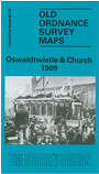
This detailed map covers the west end of Accrington, together with much of Church and Oswaldtwistle. Coverage stretches from Monk Street Accrington westward to Stanhill Mill and Church Cricket Ground, and from Albert Street Church southward to Stone Bridge Lane Oswaldtwistle. The many features include railway with Church & Oswaldtwistle station, engine shed, sidings etc; Antley Boiler Works, Union Mill, Moscow Mill, Hippings Vale Mill, Stone Bridge Mill, Rhyddings Mill, St Paul's church, Commercial Mill, Spring Hill, Paradise Works, Charter Street Works, Foxhill Bank, Print Works, Holland Bank Chemical Works, Primrose Mill, Churchbridge Mill, Canal Mill, Albion Mill, Cote Holme, White Ash Brook, tramways, Aspen Colliery, Whiteash Paper Mill, Stanhill, Stanhill Ring Spinning Mill, Higher and Lower Twinch, etc. Extracts from an Accrington trade directory are included on the reverse.
The map links up with Lancashire sheets 63.10 Rishton to the north and 63.15 Accrington to the east.