Inch to the Mile Maps of Ireland

  • These Old Ordnance Survey Maps normally cover an area of about 18 miles by 12 miles and are especially good at showing railways, roads and canals, and at giving a broad view of a wider area. Each includes an introduction and a more detailed map of a small town or village. They are available through our On-line Mapshop

  • Here is information about Sheet 45:

  • Ireland Sheet 45 Tempo & Maguiresbridge 1900 - published 1990; intro by Alan Godfrey. ISBN.978-0-85054-362-9

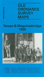
    This Inch to the Mile map covers eastern Fermanagh plus a portion of Tyrone. Coverage stretches from Enniskillen eastward to Fivemiletown, and from Trillick southward to Maguires Bridge.

    Features include part of lower Lough Erne, Enniskillen, the Clogher Valley Railway, stretches of the Great Northern Railway, Brocker Mountain, Jenkin Hill, Castle Coole, Colebrooke, Aughentaine Castle, Castle Irvine. On the reverse we include detailed plans of two villages: One is Tempo, incl Fair Green, Tempo Bridge, churches, individual buildings shown along the main (only) street. The other is Maguiresbridge, incl Christ Church, RC church, Clogher Valley Railway with Maguiresbridge Green Stopping Place. A directory for Maguiresbridge is also included.


    It is not possible to list the many hamlets, farmsteads and other topographical features shown on these maps. However, you may find it useful if we list the towns and principal villages or church parishes that are included on this map. Links are given for those for which detailed large-scale maps are also available.

  • Co Fermanagh: Aghalurchen, Ballinamallard, Brookeborough, Clabby, Colebrooke, Creagh, Derryvullan, Enniskillen, Garvary, Killarbran, Lisbellaw, Maguiresbridge, Tempo.
  • Co Tyrone: Fivemiletown, Trillick.
  • An index map is available showing the areas covered by the Inch to the Mile maps. Go to This Index Map.
  • For a full list of maps for One Inch maps for Ireland go to the Ireland Inch to the Mile page; or for other maps of Ireland visit the Ireland page.
  • You can order maps direct from our On-line Mapshop. For other information and prices, and other areas, go to The Index Page.
    Alan Godfrey Maps, Prospect Business Park, Leadgate, Consett, Co Durham, DH8 7PW / sales@alangodfreymaps.co.uk / 16 January 2018