 Here is information about Sheet 32:
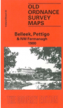
This Inch to the Mile map is split roughly equally between Counties Donegal and Fermanagh. Coverage stretches from Belleek eastward to Kesh and northward to Lough Derg.
Features include much of lower Lough Erne, Lough Derg, Boa Island, the Great Northern Railway, Lustymore Island, Shinnan Hill, Crockkinagoe.
On the reverse we include two large scale maps. One is for the Fermanagh Village of Belleek, famous for its Pottery Works; other features include railway with station, RC church, hotels, White Cat Cave etc. The second plan is for Pettigoe (or Pettigo), split between Donegal and Fermanagh and this shows the village in detail; features include the Main Street with individual buildings, part of the station, churches, corn and saw mills. We also include directories for both villages.
It is not possible to list the many hamlets, farmsteads and other topographical features shown on these maps. However, you may find it useful if we list the towns and principal villages or church parishes that are included on this map. Links are given for those for which detailed large-scale maps are also available.