
 Here are the details of maps for Huntingdon:

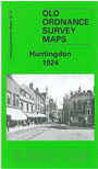
This detailed map covers most of the town of Huntingdon, with coverage extending from St Mary's church westward to Hinchinbrooke Park, and northward toSt Peter's Road.
Features include LNER railway with North and East stations, engine shed, Poor Law Institution, County Hospital, St Mary's Motor Works, All Saints church, St Mary's church, gas works, Castle Hills, Trinity church, Walden House, High Street area, town centre with individual buildings neatly shown, Cromwell Square, Edison Bell Works, Turnip Piece, Hinchinbrooke House, Hinchinbrooke Farm etc. On the reverse we include a 1924 commercial directory of the town.
The map links up with Huntingdon sheet 18.14 Huntingdon East to the east.
Follow this link for a complete list of our Huntingdonshire Series maps.
You can order maps direct from our On-line Mapshop. For other information and prices, and other areas, go to The Index Page.
Maps in the Godfrey Edition are taken from the 25 inch to the mile map and reduced to about 15 inches to the mile. For a full list of maps for England, return to the England page.
Alan Godfrey Maps, Prospect Business Park, Leadgate, Consett, Co Durham, DH8 7PW / sales@alangodfreymaps.co.uk / 28 July 2010