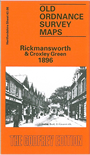
 Here are the details of maps for Rickmansworth:

This detailed map of Rickmansworth is double-sided for maximum coverage. The main map covers the High Street area of Rickmansworth, with coverage northward to Croxley Green and Milestone Field. Features include Metropolitan Railway with station (at western edge of map), town centre with individual buildings neatly shown, Mineral Water Works, Brewery, malthouse, Croxleyhall Farm, Croxleyhall Wood, Rickmansworth Park, Scotsbridge House, Scotsbridge Mill, Highfield House, All Saints church, pubs, Dickinson Institute, stretch of Grand Junction Canal, etc.
On the reverse we include a portion of adjacent sheet 43.12 extending coverage south to include St Mary's church, Grand Junction Canal with locks, Print Works, Batchworth, Frogmoor House. We also include an 1899 directory.