Old Ordnance Survey Maps of Hertfordshire

  • These detailed maps normally cover an area of about one and a half miles by one mile. Each map includes an introduction.
  • They are available through our On-line Mapshop

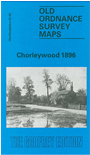
  • Here are the details of maps for Chorleywood:

  • Hertfordshire Sheet 43.03 Chorleywood 1896 - published 1991; intro by Alan Godfrey. ISBN.978-0-85054-457-2

    This detailed map of Chorleywood is double-sided for maximum coverage. The main map covers the village centre with coverage extending eastward to Glen Chess and Loudwater Farm. Features include Dairy Farm, Loudwater House, Millfield Plantation, Solesbridge Mill, Rookery Wood, Handpost Spring, Chorleywood Cedars, Artichoke Dell, Appletree Farm, Christ Church, Chorleywood House, Beechengrove Wood.

    On the reverse we include part of adjacent sheet 43.02 extending coverage westward to the Buckinghamshire border. Features here include Chorleywood station, Berkeley Arms, Chorleywood Kennels, Currants Bottom. We also include an 1899 directory of Chorleywood.


  • Follow this link for a complete list of our Hertfordshire Series maps or go to the Chilterns page for other counties in the region.
  • You can order maps direct from our On-line Mapshop. For other information and prices, and other areas, go to The Index Page
  • Maps in the Godfrey Edition are taken from the 25 inch to the mile map and reduced to about 15 inches to the mile. For a full list of maps for England, return to the England page.
    The Godfrey Edition / sales@alangodfreymaps.co.uk / 28 January 2018