Old Ordnance Survey Maps of Hertfordshire

  • These detailed maps normally cover an area of about one and a half miles by one mile. Each map includes an introduction.
  • They are available through our On-line Mapshop

  • Here are the details of maps for Berkhamsted:

  • Hertfordshire Sheet 33.05 Berkhamsted 1897 - published 1990; intro by Pamela Taylor. ISBN.978-0-85054-344-5

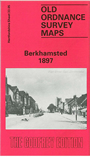
    This detailed map gives good coverage of Berkhamsted (or Berkhampstead). Coverage runs from Gossom's End eastward to St Michael's church and the Lower Mill.

    Features include town centre with each building neatly shown, railway with station, Castle, Tower Hill, White Hill, Berkhampstead Hall, Grand Junction Canal with locks, St Peter's church, Highfield House, schools, Oakland Villas, Upper Mill, Lower Mill, New Lodge, Grammar School, St Michael's church, Friends Meeting House, nurseries, pubs etc. On the reverse we include an 1899 directory of the town.


  • Follow this link for a complete list of our Hertfordshire Series maps or go to the Chilterns page for other counties in the region.
  • You can order maps direct from our On-line Mapshop. For other information and prices, and other areas, go to The Index Page
  • Maps in the Godfrey Edition are taken from the 25 inch to the mile map and reduced to about 15 inches to the mile. For a full list of maps for England, return to the England page.
    The Godfrey Edition / sales@alangodfreymaps.co.uk / 28 January 2018