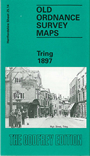
Hertfordshire Sheet 25.14 Tring 1897 - published 1995; intro by Elizabeth Lockwood. ISBN.978-0-85054-714-6 
This detailed map covers the small town of Tring. The town itself is in the top half of the map and features there include the parish church,
Dunsley Cottage, The Mansion, malthouses, Home Farm, Elm House, Church House, Parsonagebottom Farm, Okeford, Frogmore, High Street,
cattle market, King Street, Western Road. Coverage extends south to much of Tring Park, and westward to the cemetery and West Leith. Note that the station is not on the map.
A directory of Tring in 1899 is included on the reverse.
Follow this link for a complete list of our Hertfordshire Series maps or go to the Chilterns page for other counties in the region.
You can order maps direct from our On-line Mapshop.
For other information and prices, and other areas, go to The Index Page
Maps in the Godfrey Edition are taken from the 25 inch to the mile map and reduced to about 15 inches to the mile.
For a full list of maps for England, return to the England page.
The Godfrey Edition / sales@alangodfreymaps.co.uk / 28 January 2018
 Here are the details of maps for Tring: