
 Here are the details of maps for Bristol NE:

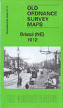
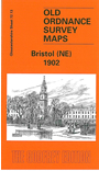
We have published two versions of this busy map, showing how the area changed across the years. Coverage stretches from Castle Street eastward to Lyppiatt Road and Avonvale Road, and from Old Bread Street northward to Lower Ashley Road and Baptist Mills.
The many features include Midland Railway St Philip's Station Branch with terminus and Goods Shed, GWR railway with Lawrence Hill station, Netham Works (in SE corner), engine shed, Holy Trinity church, St Philip & St Jacob's church, St Philip's Bridge over Floating Harbour, St Paul's church with St Paul's district, Public Library, Portland Square, soap works, River Frome, Bristol Wagon Works, Easton Colliery, Frog Marsh, The Wilderness, etc.
Each map also includes a selection of early street directory entries.
The map links up with sheets 72.09 Ashley Down to the north, 71.16 Bristol NW to the west, 72.14 St Georges to the east and 76.01 Bristol SE to the south.
Maps in the Godfrey Edition are taken from the 25 inch to the mile map and reduced to about 15 inches to the mile. For a full list of maps for England, return to the England page.
Alan Godfrey Maps, Prospect Business Park, Leadgate, Consett, Co Durham, DH8 7PW / sales@alangodfreymaps.co.uk / 30 November 2018