
 Here are the details of maps for Shirehampton:

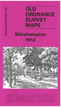
This detailed map covers the village of Shirehampton, NW of Bristol. Features in the village include St Mary's church, George Inn, Oldfield House, The Priory etc. Coverage extends eastward to part of Shirehampton Park, northward to King's Weston House, westward to West Town. To the south is the Great Western & Midland Joint Railway with Shirehampton station, the River Avon, and part of Pill, including Crockern Pill and (at foot of map) station. On the reverse we include a directory of Shirehampton and a timetable for the Clifton Down to Avonmouth Dock railway.
Maps in the Godfrey Edition are taken from the 25 inch to the mile map and reduced to about 15 inches to the mile. For a full list of maps for England, return to the England page.
Alan Godfrey Maps, Prospect Business Park, Leadgate, Consett, Co Durham, DH8 7PW / sales@alangodfreymaps.co.uk / 28 October 2016