
 Here are the details of maps for Avonmouth:

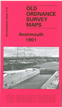
This map covers the port of Avonmouth, opened in 1877, and is a valuable addition to our group of maps for the Bristol area. The map shows Avonmouth Dock in detail, including railway sidings, locks, even mooring posts. Other features include St Andrew's church, Dock station, Marine Hotel, Swash Channel, Dunball Island, isolation hospital, Pier station, lighthouse, cattle lairs, and the group of streets nearby. On the reverse we include a directory of Avonmouth in 1904, plus railway timetables for the Pilning-Avonmouth line in 1929 and Clifton-Avonmouth line 1906.
Maps in the Godfrey Edition are taken from the 25 inch to the mile map and reduced to about 15 inches to the mile. For a full list of maps for England, return to the England page.
Alan Godfrey Maps, Prospect Business Park, Leadgate, Consett, Co Durham, DH8 7PW / sales@alangodfreymaps.co.uk / 28 October 2016