
 Here are the details of maps for Chepstow:

Although Chepstow is very much a Monmouthshire and Welsh town, we have used the Gloucestershire maps because the sheetlines are better in that series.
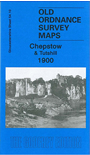
This detailed map is douible-sided for maximum coverage. The main map covers most of the town centre, incl Workhouse, Castle, St Mary's church, High Street, Bridge Works, north part of station and Tubular Suspension Bridge, Chepstow Bridge etc. Coverage extends west to The Mount, St Maux College, St Kingsmark, Crossway Green, Bishop's Barnet Wood. The map also includes part of Tutshill on the Gloucestershire side of the Wye, incl Tutshill House, site of St David's Chapel, Wirewood's Green.
On the reverse we include part of adjacent sheet 54.14 extending coverage south to include south part of station, Hardwick Court, High Beech, St Lawrence, Fairfield Farm, Tallard's Marsh.
Maps in the Godfrey Edition are taken from the 25 inch to the mile map and reduced to about 15 inches to the mile. For a full list of maps for England, return to the England page.
Alan Godfrey Maps, Prospect Business Park, Leadgate, Consett, Co Durham, DH8 7PW / sales@alangodfreymaps.co.uk / 28 October 2016