
 Here are the details of maps for Coleford:

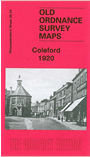
This detailed map covers the small town of Coleford, at the western edge of the Forest of Dean. The town is central to the map, and features here include both railway stations with railway tracks, Market Place, Town Hall, St John's church, and all houses and other buildings neatly shown. Coverage extends SW to Whitecliff, incl old limekilns and quarries; east to Lord's Hill and to the urban district boundary; NE to Poolway, Poolgreen, Baker's Hill, Littledean Lane End and Broadwell Farm. On the reverse we include an 1894 directory of Coleford.
Maps in the Godfrey Edition are taken from the 25 inch to the mile map and reduced to about 15 inches to the mile. For a full list of maps for England, return to the England page.
Alan Godfrey Maps, Prospect Business Park, Leadgate, Consett, Co Durham, DH8 7PW / sales@alangodfreymaps.co.uk / 28 October 2016