
 Here are the details of maps for Cheltenham:


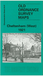
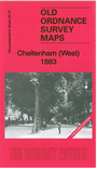
We have published 2 versions of this map, showing how the area changed across the years. The 1883 version is in full colour, taken from the beautiful handcoloured 1st Edition OS map.
The maps cover the western half of the town, with coverage stretching from St Mary's church and Vittoria Walk westward to Granley Road and Libertus Road. Major features include the Winter Gardens, Montpelier Gardens, The Promenade, Royal Crescent, St George's Square, St James Square station, Malvern Road station, Lansdown station, Upper Alstone, Lower Alstone, Lansdown, Dean Close Memorial School, Sunningend Works, Lansdown Crescent, Christ Church Road, Overton Park, St Paul's Training College, St Mary's Hall Training College, cemetery. On the reverse we include extracts from early directories.
The map links up with a map for Cheltenham East.
Maps in the Godfrey Edition are taken from the 25 inch to the mile map and reduced to about 15 inches to the mile. For a full list of maps for England, return to the England page.
Alan Godfrey Maps, Prospect Business Park, Leadgate, Consett, Co Durham, DH8 7PW / sales@alangodfreymaps.co.uk / 28 October 2016