
 Here are the details of maps for Landaff:

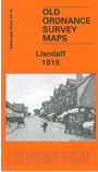
This very detailed map covers much of Llandaff and the northern part of Canton. Today this is all part of Cardiff. Coverage stretches from Windway Road eastward to Cathedral Road, and from the River Taff southward to Romilly Road. The centre of Llandaff is in top left quarter of the map and features here include the Cathedral, Llandaff House, Llandaff Mill, castle remains, The Palace, Minor Canonries, etc. Elsewhere features include the north part of Victoria Park, Howell's School, Llandaff Fields, Sir David's Fields, St Catherine's church, Pontcanna, Anchor Patent Fuel Works, Crown Wagon & Engineering Works, Star Patent Fuel Works etc plus a short stretch of the Glamorganshire Canal. On the reverse we include a directory of Llandaff in 1906.
The map links up with sheet 43.11 Cardiff North to the north and 43.14 Canton to the south.