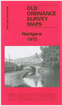
Glamorgan Sheet 36.08 Nantgarw 1915 - published 2011; intro by Derrick Pratt. ISBN.978-1-84784-490-3 
This detailed map covers the area around and to the north of Nantgarw.
Features include Taff Vale Railway, Cardiff Railway, Barry Railway, stretch of Walnut Tree Branch, stretch of Pontypridd Caerphilly & Newport line,
Nantgarw village, Nantgarw Colliery, Dyffryn-isaf, Glamorganshire Canal, pottery, etc.
The map links up with sheet 36.12 Taffs Well to the south.
Follow this link for a complete list of our Glamorgan maps.
You can order maps direct from our On-line Mapshop.
For other information and prices, and other areas, go to The Index Page.
Maps in the Godfrey Edition are taken from the 25 inch to the mile map and reduced to about 15 inches to the mile.
For a full list of maps for Wales, return to the Wales page.
The Godfrey Edition / sales@alangodfreymaps.co.uk / 30 March 2018

 Here are the details of maps for Nantgarw: