
 Here are the details of maps for Pontypridd (N):

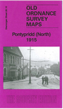
This detailed map covers the northern half of Pontypridd.
Features include Hopkinstown, Pwll-Gwaun, Trallwng, River Taff; Taff Vale Railway with many junctions, sidings etc; St Matthew's church, St Catherine's church, Town Hall, tramways, Newbridge Chain & Anchor Works, Pwll-gwaun Colliery, Ty-mawr Colliery, Victoria Bridge etc. On the reverse we include 1906 directories for Hopkinstown and Pwllgwaun.
The map links up with Glamorgan sheets 28.14 Pontypridd South to the south.