Old Ordnance Survey Maps of Glamorgan

  • These detailed maps normally cover an area of about one and a half miles by one mile. Each map includes an introduction.
  • They are available through our On-line Mapshop

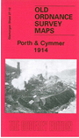
  • Here are the details of maps for Porth & Cymmer:

  • Glamorgan Sheet 27.12 Porth & Cymmer 1914 - published 2008; intro by Derrick Pratt. ISBN.978-1-84784-171-1

    This very detailed map covers a fascinating part of the Rhondda valley, including the busy villages of Porth and Cymmer. Coverage extends from Llwyncelyn westward towards Graig-ddu, and SW to Trebanog and Edmondstown. The many features include Mynydd y Cymmer, Cymmer colliery, Taff Vale Railway with station, Glynfach colliery (disused), tramways, St John's church, chapels, Rhondda River, Upper Cymmer colliery, rescue training station, streets of terraces with each house neatly shown, and much else. We include directories of Porth and Cymmer on the reverse.


  • Follow this link for a complete list of our Glamorgan maps.
  • You can order maps direct from our On-line Mapshop. For other information and prices, and other areas, go to The Index Page.
  • Maps in the Godfrey Edition are taken from the 25 inch to the mile map and reduced to about 15 inches to the mile. For a full list of maps for Wales, return to the Wales page.
    The Godfrey Edition / sales@alangodfreymaps.co.uk / 30 March 2018