
 Here are the details of maps for Treharris and Quaker's Yard:

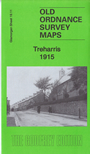
This detailed map covers the villages of Treharris, Trelewis, Quaker's Yard and Edwardsville.
Features include Quaker's Yard Junction with High Level and Low Level stations, Edwardsville, South Wales & Monmouthshire Truant School, River Taff, Taff Vale Railway, GW & Rhymney Joint Railway (Merthyr & Quaker's Yard branch), Blackbrook, Quaker's Yard, Treharris, Bargoed House, GWR Vale of Neath line with Treharris station, Melin-caiach, Ocean Deep Navigation Colliery with sidings and engine house, Glyn Bargoed, Trelewis, Taff Bargoed Branch with Trelewis Halt, churches and chapels, schools etc. A 1906 directory of Treharris is included on the reverse.
The map links up with Glamorgan sheet 19.10 Penrhiwceiber to the west.