Old Ordnance Survey Maps of Glamorgan

  • These detailed maps normally cover an area of about one and a half miles by one mile. Each map includes an introduction.
  • They are available through our On-line Mapshop

  • Here are the details of maps for Mountain Ash:

  • Glamorgan Sheet 19.05 Mountain Ash 1898 - published 2009; intro by Derrick Pratt. ISBN.978-1-84784-326-5

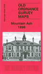
    This detailed map covers the busy town of Mountain Ash, in the Cynon Valley. Coverage stretches from Aber-ffrwyd Road southward to Springfield Street.

    Features include Navigation Colliery, Deep Dyffryn Colliery, St Margaret's church, Graig-isaf Quarry, Miskin area, Newtown area, Fforest-uchaf, Afon Cynon, Aberdare Railway with station, GWR railway with station, Town Hall, Graig Isaf, Graig Daren-las, Graig-hwnt Plantation, tramways to quarries, St David's church, St Teilo's church, engine shed, schools, etc. We include a commercial directory of Mountain Ash on the reverse.


  • Follow this link for a complete list of our Glamorgan maps.
  • You can order maps direct from our On-line Mapshop. For other information and prices, and other areas, go to The Index Page.
  • Maps in the Godfrey Edition are taken from the 25 inch to the mile map and reduced to about 15 inches to the mile. For a full list of maps for Wales, return to the Wales page.
    The Godfrey Edition / sales@alangodfreymaps.co.uk / 30 March 2018