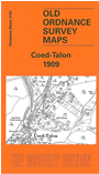
 Here are the details of maps for Coed-Talon:

This detailed map is double-sided for maximum coverage. The main map covers the area from Coed-Talon northward to Albert Street. Features include Pont-y-bodkin area, LNWR Ffrith Branch, LNWR Mold & Tryddyn line with Coed-Talon West, South and East Junctions and station, Erith Brick Works, Queen Street area, Leeswood area, Long Row, Albert Street area, Phoenix Collieries with tramway, old coal shafts, chapels, Frank Farm, Fferm, etc.
On the reverse we include part of adjacent sheet 17.05 extending coverage southward to include Coed-Talon Banks, stretch of GW & LNWR Wrexham & Minera Joint Line, Offa's Dike, Tan-llan Colliery with tramway, Wood Pit Colliery, Tryddyn Lodge Colliery with railway, Alyn Brick Works, old shafts etc.